Floods: Aerials of RiverThames from Central London through West London and Buckinghamshire
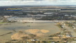
Floods: Aerials of RiverThames from Central London through West London and Buckinghamshire; AIR VIEWS (AERIALS) Flood waters surrounding Chertsey bridge / Digger on water covered road with blue pipes and pump next to houses / flood water on land around motorway M3 / partially submereged trees and building / M25 junction (near Staines) / countryside with forest, woodland / Eton Dorney lake


PURCHASE A LICENSE
Get personalized pricing by telling us when, where, and how you want to use this asset.
DETAILS
Restrictions:
No use by national or regional TV or radio news in UK and Ireland until 4 days after date of creation. Prior approval required if clip features ITN newsreader or reporter in sound or vision, please contact your local Getty Images representative.No use by regional TV or radio in UK and Ireland until 3 days after date of creation. Prior approval required if clip features ITN newsreader or reporter, please contact your local Getty Images representative.
Credit:
Editorial #:
688960526
Collection:
ITN
Date created:
February 11, 2014
Upload date:
License type:
Rights-ready
Release info:
Not released.��More information
Clip length:
00:13:10:03
Location:
United Kingdom
Mastered to:
QuickTime 8-bit Photo-JPEG SD 720x576 25p
Originally shot on:
576 25i
Source:
ITN
Object name:
r11021418_54597.mov
- London - England,
- Water,
- Accidents and Disasters,
- Backhoe,
- Blue,
- Bridge - Built Structure,
- Buckinghamshire,
- Built Structure,
- Chertsey,
- Color Image,
- Dorney,
- Dorney Lake,
- Environment,
- Environmental Issues,
- Extreme Weather,
- Film - Moving Image,
- Flood,
- Forest,
- House,
- Lake,
- Multiple Lane Highway,
- Raw Footage,
- Real Time Video,
- Road,
- Social Issues,
- Surrounding,
- Tree,
- UK,
- Video with Sound,
- Wind,
- Woodland,