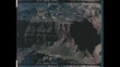
Aerial footage of Glen Canyon National Recreation Area, Utah, U.S.A., 1970
Aerial footage of Glen Canyon National Recreation Area, Utah, U.S.A., 1970.
Glen Canyon National Recreation Area (shortened to Glen Canyon NRA or GCNRA) is a national recreation area and conservation unit of the United States National Park Service that encompasses the area around Lake Powell and lower Cataract Canyon in Utah and Arizona, covering 1,254,429 acres (5,076.49 km2) of mostly rugged high desert terrain. The recreation area is named for Glen Canyon, which was flooded by the Glen Canyon Dam, completed in 1966, and is now mostly submerged beneath the waters of Lake Powell.


PURCHASE A LICENSE
Get personalized pricing by telling us when, where, and how you want to use this asset.
DETAILS
Editorial #:
2199477348
Collection:
Archive Films: Editorial
Date created:
January 01, 1970
Upload date:
License type:
Rights-ready
Release info:
Not released.��More information
Clip length:
00:00:13:04
Location:
Utah, United States
Mastered to:
QuickTime 12-bit ProRes 4444 HD 1920x1080 24p
Source:
Archive Films Editorial
Object name:
xd30932_1310aerialfootageofglencanyonnationalrecreationarea
- 1970,
- Aerial View,
- Archival,
- Arts Culture and Entertainment,
- Beauty,
- Canyon,
- Cliff,
- Color Image,
- Environmental Issues,
- Film - Moving Image,
- Glen Canyon,
- Glen Canyon National Recreation Area,
- HD Format,
- High Angle View,
- Horizontal,
- Landscape - Scenery,
- Monument,
- Moving Image,
- National Monument,
- National Park,
- Natural Arch,
- Nature,
- Outdoors,
- Produced Segment,
- Real Time Video,
- Rock - Object,
- Rock Formation,
- Spire,
- USA,
- Utah,
- Video,
- Video with Sound,
- Winter,