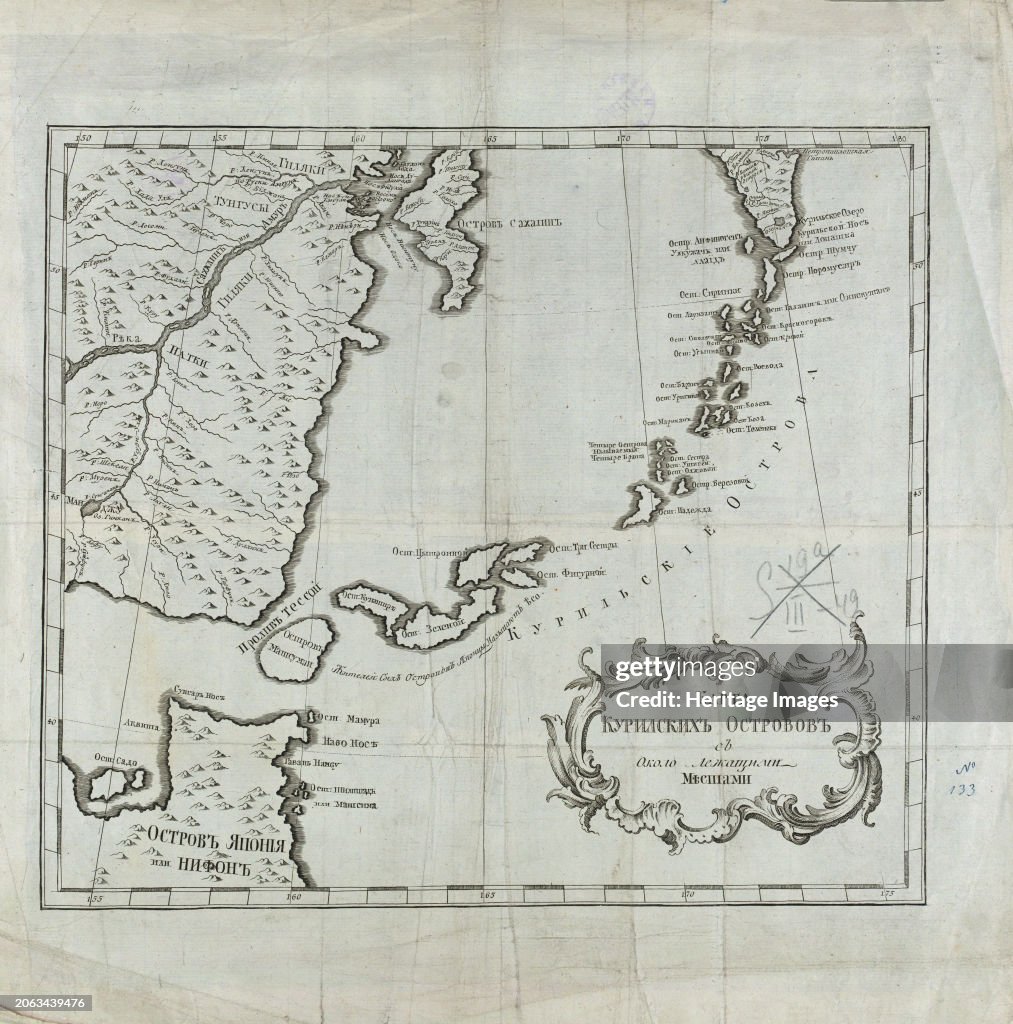
Map Of The Kuril Islands With Surrounding Areas
Map of the Kuril Islands with Surrounding Areas, 1700-1799. This 18th century Russian map depicts the Kurile Islands archipelago, located on the far eastern edge of the Russian Empire. Although inaccurate in places, the map attempts to show the large and small islands throughout the entire chain. Most of the Kurile Islands are listed by name, a geographical specificity quite unusual for such a remote region in this era. As with the nearby Aleutian Islands, by this time these islands had been repeatedly visited by both Russian maritime explorers and hunters of sea otter. Sakhalin Island is also seen toward the upper center of the map, alongside the Russian mainland, as is the Kamchatka Peninsula toward the upper right. Some rivers, lakes, and other bodies of water are listed by name. Relief is indicated pictorially in places. Northern Japan, principally Hokkaido, is shown toward the lower left of the map. Geographic coordinates for longitude on this map are measured from Ferro (present-day Hierro), the westernmost of the Canary Islands (the western edge of the world known to the ancients), used by geographers back to the time of Ptolemy as a base point prior to the agreement in 1884 that the prime meridian would run through Greenwich, England. Creator: Unknown. (Photo by Heritage Art/Heritage Images via Getty Images)

PURCHASE A LICENSE
How can I use this image?
€300.00
EUR
Getty ImagesMap Of The Kuril Islands With Surrounding Areas, News Photo Map Of The Kuril Islands With Surrounding Areas Get premium, high resolution news photos at Getty ImagesProduct #:2063439476
 Map Of The Kuril Islands With Surrounding Areas Get premium, high resolution news photos at Getty ImagesProduct #:2063439476
€475€115
Getty Images
In stockPlease note: images depicting historical events may contain themes, or have descriptions, that do not reflect current understanding. They are provided in a historical context. .
DETAILS
Restrictions:
Contact your local office for all commercial or promotional uses.
Credit:
Editorial #:
2063439476
Collection:
Hulton Archive
Date created:
January 01, 1900
Upload date:
License type:
Release info:
Not released.��More information
Source:
Hulton Archive
Object name:
3004152
Max file size:
4943 x 4998 px (16.48 x 16.66 in) - 300 dpi - 17 MB
- 18th Century,
- 18th Century Style,
- Alaska - US State,
- Aleutian Islands,
- Archipelago,
- Business Finance and Industry,
- Color Image,
- Colors,
- Geographical Locations,
- Headland,
- History,
- Hokkaido,
- Human Interest,
- Industry,
- Japan,
- Kamchatka Peninsula,
- Kuril Islands,
- Library,
- Library of Congress,
- Map,
- Nautical Vessel,
- Peninsula,
- Photography,
- Physical Geography,
- Russia,
- Sakhalin Island,
- Sakhalin Oblast,
- Shipping,
- Surrounding,
- USA,
- Vertical,
- View Into Land,