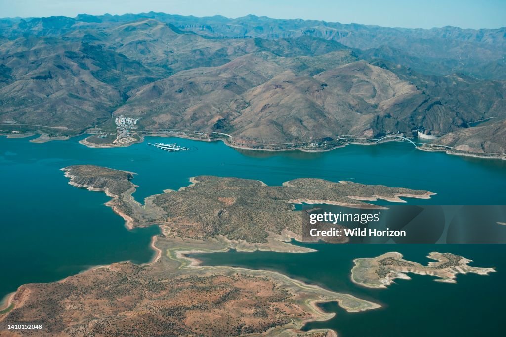
High aerial view of Theodore Roosevelt Lake, bridge, dam, and the Salt River in the canyons below
Aerial photo of Theodore Roosevelt Lake, islands, bridge, and dam on the Salt River. The lake is in Tonto National Forest and mostly in Gila County, Arizona. The 'bathtub ring' along the shore and around these islands shows how much the water level has been dropping. Aerial support by LightHawk. (Photo by: Wild Horizon/Universal Images Group via Getty Images)

PURCHASE A LICENSE
How can I use this image?
€300.00
EUR
Getty ImagesHigh aerial view of Theodore Roosevelt Lake, bridge, dam, and the..., News Photo High aerial view of Theodore Roosevelt Lake, bridge, dam, and the... Get premium, high resolution news photos at Getty ImagesProduct #:1410152048
 High aerial view of Theodore Roosevelt Lake, bridge, dam, and the... Get premium, high resolution news photos at Getty ImagesProduct #:1410152048
€475€115
Getty Images
In stockPlease note: images depicting historical events may contain themes, or have descriptions, that do not reflect current understanding. They are provided in a historical context. .
DETAILS
Restrictions:
Contact your local office for all commercial or promotional uses.
Credit:
Editorial #:
1410152048
Collection:
Universal Images Group
Date created:
June 30, 2022
Upload date:
License type:
Release info:
Not released.��More information
Source:
Universal Images Group Editorial
Object name:
930_01_taw-6007_2022-2022-aerial-roosevelt-lake-dam-az_dn
Max file size:
5500 x 3670 px (18.33 x 12.23 in) - 300 dpi - 6 MB
- Arizona,
- Accidents and Disasters,
- Aerial View,
- Bridge - Built Structure,
- Climate Change,
- Color Image,
- Dam,
- Drought,
- Environment,
- Extreme Weather,
- High Angle View,
- Horizontal,
- Human Interest,
- Island,
- Lake,
- Mountain,
- No People,
- Photography,
- Reservoir,
- Road,
- Running Water,
- Salt River,
- Social Issues,
- Theodore Roosevelt Dam,
- Theodore Roosevelt Lake,
- Tonto National Forest,
- USA,
- Water,